cloud progression for a warm front and depression
Sat, Mar 29, 2008
I’ve been reading about clouds for while now in the excellent The Cloudspotter’s Guide, am a follower of the The Cloud Appreciation Society and have been studying the surface charts for ages, to get an idea of what the weather will do, ahead of trips into the mountains and as I was working from home the other day I managed to nip out now and then to follow the progression of a warm front preceding a depression moving in from the west. I was expecting the classic sequence for a rise in air temperature:
Cirrus -> Cirrostratus -> Altostratus -> Nimbostratus -> Stratus -> Stratocumulus -> Cumulus
where the signs of approaching bad weather are heralded by Cirrus, which eventually joins up, spreads, lowers, thickens, rains, eases, rises, breaks up and disperses. The surface chart showed a depression coming in from the Atlantic so I settled down to some heavy duty Java programming but kept an eye on the weather:

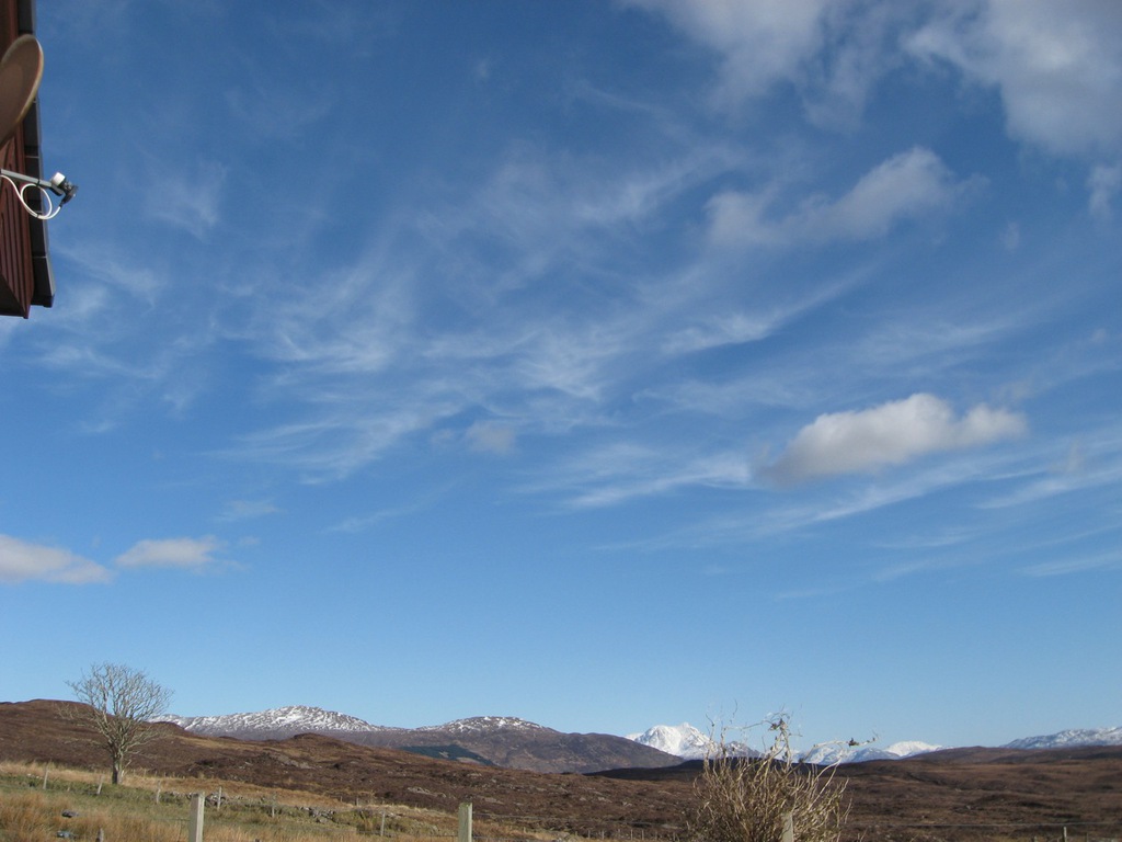
The chart shows the front approaching. It’s actually an occluded front, which can bring a lot more rain than a normal front. The morning was stunning, with superb views over to Knoydart:

Soon, however, the signs of an approaching front were appearing, with Cirrus wisps appearing from the west. I stood with my back to the wind, which was a gentle breeze from the west and noted the Cirrus spreading to my right, which was a sign that the sequence was beginning. Knowing from the charts that it was an occluded front and depression, it was likely it would take about 24 hours to build and disperse:
Next came the Cirrostratus, a high level layer of Cirrus that’s joined up and spread. It’s not enough to make much difference to the sunlight, unlike Altostratus, which comes later. Instead, the Cirrostratus forms a faint layer very high in the sky:

The Cirrostratus lasted most of the afternoon, with the Altostratus appearing just as the sun was sinking behind the western hills:

That meant the next step in the sequence was overnight, as the Altostratus brought some light rain which pattered on the windows and gradually lowered to Nimbostratus. By the next morning, the Nimbostratus was in full control of the weather and it was blowing a gale and pouring heavy rain from a leaden sky:

The rain continued all day, easing now and again but returning as heavy as ever. Around 5 in the evening it stopped raining and the next step of the sequence began, with the breaking up of the heavy Nimbostratus, to become Stratocumulus:

which later in the evening broke up into Cumulus, with a layer of Cirrostratus visible high in the sky:

So that was the full cloud progression of a depression. The winds were light and it took about 30 hours to go from clear blue skies, to heavy rain, to cumulus and blue skies again. It was about 12 hours from the first appearance of Cirrus wisps to torrential rain and very low cloud. If you see this progression start when you’re in the mountains and it’s blowing a gale you can expect the sequence to be much faster.
The day after it cleared a cold front moved in and was most impressive. The cold air underlying a cold front causes sudden uplift of the remnant of the warm air ahead of it, leading to Cumulus Congestus and Cumulonimbus. Around 8am this morning, the cold front moved in and a giant Cumulonimbus took about an hour to pass overhead, battering us with giant hail stones and treating us to a short but loud thunder and lightning storm. It’s now blue skies, strong winds and scudding Cumulus as the front moves away. There’s a lot of Cumulus Congestus around, moving fast in the wind and bringing the odd sharp and heavy downpour.
It’s a great time of year for weather watching as we’re in the path of the Atlantic depressions sweeping in on the jetstream and giving us something to talk about. The weather!
You can see all the pics in sequence here.